National Parks South Pacific Region
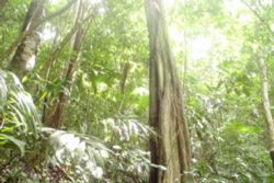
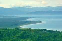
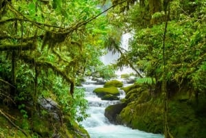
When you arrive where the mountains meet the shores, you will know that you are in the South Pacific Region of Costa Rica. Yielding both primary and secondary forest throughout, it is the least populated and developed of all Regions. Its Northern boundary lies just north of the town of Jaco and runs along the beautiful Pacific coastline all the way to Panama. To the east it is framed by the Talamanca Mountain Range with its ridges and valleys rolling all the way to the Pacific waters edge. Long ago much of the primary forest was removed making way for banana plantations and cattle fields, leaving those areas today recovering with vast patches of secondary forest cover.

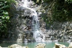
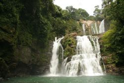
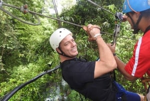
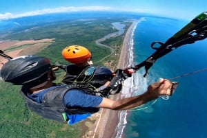
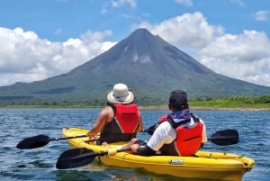
The Osa Peninsula, considered the "Jewel of the South Pacific" is one of the most beautiful and biological diverse places on earth and is host to the largest primary tropical lowlands in Central America. The climate, a mixture of sun, humidity and rainfall, constantly give the flora and fauna everything needed to flourish all year round. The rivers, abundant rainfall and natural terrain team up to offer some of the most amazing waterfalls you can ever hope to experience. Further south you come upon miles of white sandy beaches surrounding the Dulce Gulf area into what seems like a tropical wilderness in every direction you turn. While very few tourist venture to these areas, those coming to "experience the land that time has forgotten" are not sorry as the sights are unbelievable. The entire coastal waters of the South Pacific Region are well known to surfers and fisherman around the world who long ago discovered the natural beauty and challenge of these waters. Today, there are tiny villages all along the coast offering smiles and friendly faces to all visitors that come their way. Inland, this region has rolling valleys, ridge after ridge of mountain chains and rivers galore making it the perfect stop for rafting, hiking, horseback riding, or zipping through a canopy. There are numerous airports scattered throughout the region allowing travelers to easily make their way to all of the wonderful National Parks and other attractions surrounding them. Finding spots to enjoy the captivating sunset and the scenery around you is easy in the South Pacific Region of Costa Rica. You only have to get here first.
Chirripo National Park - The Tallest Mountain in Costa Rica
Manuel Antonio National Park - Beautiful Beaches & Wildlife
Marino Ballena National Park - Dolphins, Whales & More
Corcovado National Park - The Jewel of the Osa Peninsula
Piedras Blancas National Park - Rainforest Biodiversity
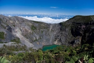
Chirripo National Park - Just northeast of San Isidro del General, Chirripo National Park is spread over more than 125,000 acres of raw beauty. The immense land mass of this park is located in the Provinces of Puntareneus, Cartago and Limon. Hosting the highest peak in the country at 12,352 feet, the change in it's altitudes allows the visitor to see first hand how it effects the flora and fauna. The lower slopes are primary cloud and rainforest that hold primarily large oaks and elms. You find a variety of wildlife such as monkeys, quetzal as well as a variety of birds. This habitant changes considerably around 9000 feet as the dense forest leaves way for thin trees, moss covered paths, and paramo. As you travel even higher, you will observe wind blown trees, short shrubs, perinial plants and raspy grass. Once you hit the summit you have beautiful views of the lakes, remenents of glacier activity that had to take place here well before man. There are many great trails to any of the five peaks in the park but hitting the summit in a one day hike is not advised. The trail is over 30 miles long and brings below freezing temperatures at night once the sun goes down. Los Crestones Base camp is equipped with bunk beds, a cooking area, and cold showers but reservations are required. The only other camping allowed in the Park is at the Indian Pass Camping Area along the Uran Trail. No resources for food are located within the park but there is ample resources in San Isidro del General or Cartago. If camping is not your style, there are numerous quaint cabins and hotels located outside the park that are all inclusive accommodations.
Area 125,600 acres
Location 9.48°N, 83.48°W - South Pacific Region
San Jose, Limon and Cartago Provinces
Max. Elevation 12,532' Chirripo Peak
Precipitation up to 150 inches annually
Date of Creation 30 August 1975
Protected Areas close to Chirripo National Park include Los Santos Forest Reserve, Rio Maucho Forest Reserve, and Paramo Wildlife Refuge.
Manuel Antonio National Park - Located just south of Quepos, Manuel Antonio Park is a favorite for tourism and has a high visitation rate. Once you wind through the small paved road from Quepos towards Manuel Antonio, it takes less than a second for one to see why this park and it's beaches are so popular. Covering 4,014 acres, the volcanic rock cliffs rise above a white sandy beach with awesome views of the small islands in the cove. The forested area above the cliffs host a variety of all the unique flora and fauna that Costa Rica which is plentiful throughout this park. Extensive trails run through the park and are very easy to navigate to key points where the views are fabulous. The three primary beaches of the park are Playas Espadilla Sur, Manuel Antonio and Puerto Escondido with the mouth of the Rio Naranjo forming the southern border. Because the park includes the beaches inside it's boundaries, there are plenty of choices for food and shopping within walking distance from the park entrance all the way down to beach level. Its the perfect way to spend an entire day by first hiking the trails, catching a wave or two on the beach, casually enjoy lunch and settling in where you are bound to see the most awesome sunset. There are many accommodations in this area so spending more than one day in this little piece of heaven is certainly not out of the question. The perfect packing for a day at this beautiful park is bathing suit, shades, suntan lotion and a pair of comfortable shoes.
Area 4,014 acres
Location Central Pacific Region - Puntarenas Province
Date of Creation 23 October 1972
Protected Areas close to Manuel Antonio National Park include Transilvania Refuge, Portalon Refuge, and Cataratus de Cerro Redondo Refuge.
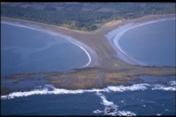
Ballena National Marine Park - Located just south of Dominical, Ballena National Park gets its name from the ballena or whales that visit its waters every year. The humpback whales come in large pods from December to late March to use the warm waters off the coast as breeding grounds. Taking one of the boat tours offered gives the visitor the up close experience of enjoying these magnificent creatures as well as seeing where the mountains meet the shores from a different perspective. Local surfers often see the whales as they are waiting on the next surge while others spot them from the porches of nearby homes above the park. The park includes a well known landmark known as "Whales Tail" which forms the tail by a tombolo and two offshore islands, Las Tres Hermanas (The Three Sisters) and Isla Ballena (Whale Island). Whales Tail is one of the largest natural sand bars on this side of the world and once you hike out to it - immense size sticks in your mind. Soon after the Japan earthquake and sunami Whales Tail was slightly altered in its shape as some of the sands between the tombolo and islands diminished. We hope to keep you updated on the findings and will post them to the web sight as the details unfold. The reefs and natural coral in this marine park make for great snorkeling and diving which can be enjoyed year round. The park has four entrances and offers a variety of tours at any of the ranger stations. Camping is allowed on designated parts of the beach but there are no facilities at the camping sights. If you require accommodations, there are numerous choices from cabins, hotels, and eco-lodges from Uvita to Dominical.
Area 495 terrestrial acres
13,280 marine acres
Location South Pacific Region - Puntarenas Province
Date of Creation 17 July 1992
Protected Areas close to Ballena Marine National Park include Rancho La Merced Wildlife Refuge and Terraba Sierpe Wetlands.
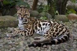
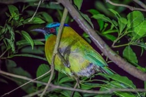
Corcovado National Park - Located in the magnificant Osa Peninsula, Corcovado National Park is the largest single area tropical lowland rainforest in Central America. This area is truly the last frontier for Costa Rica as it has few villages and few tourists find there way down each year. The natural drainage for the Corcovado Basin, these lowlands have numerous rivers and meandering creeks running throughout it with 13 known distinctive habitats. The upland has steep terrain caused by aged tectonic plate movement, daily tremors and an abundance of annual rainfall. The northern and southern rims are joined on the west by 12 miles of unspoiled beaches, coves and caves. The Sirena River pours out to the ocean midway between and has a history of torrid currents, bull sharks and crockadiles so swimming in this area is not advised. There are a variety of trails that allow the hikers the opportunity to see 115 amphibian and reptile species, 400 species of birds, 140 of mammals, over 40 species of fish and 400 species of trees. There are rare and endangered species of plants and fauna that make it a special place to protect so the government did so in 1975 after stopping illegal logging in the area. While you are in the area you may want to take the opportunity to visit Cano Island off the coast of Corcovado National Park. Tours to Cano Island Biological Reserve are offered from Sierpe River area all the way down to Dulce Gulf. You can find Corcovado National Park by traveling south on the Interamerican Highway to Chacarita. You can enter through the towns of Drake on the west end, La Palma on the south end and Puerto Jimenez. It may be a challenge finding it but certainly worth it for the true nature lovers of the world. Some camping is allowed inside the park in designated areas which are well marked. For additional accommodations, you must travel back to La Palma or Puerto Jimenez although there are a few scattered eco-lodges and cabins along the way.
Area 104,900 acres
Max. Elevation 2,444' Cerro Rincon
Temperature Ranges from 75ºF to 90ºF
Precipitation 120 - 240 inches per year
Location South Pacific Region, Osa Peninsula, Puntareneas Province
8°27'-8°39'N 83°25'-83°45'W
Date of Creation 31 October 1975
Protected Areas close to Corcovado National Park include Golfo Dule Forest Reserve, Terraba-Sierpe National Wetlands, Cacyra Refuge, Lacustrino Pejeperrito Wetlands, Lagunazul Refuge, Pejeperlo Refuge, Rio Piro Refuge, Osa Refuge, Hacienda Copano Refuge, and Preciosa Platenares Refuge.
Piedras Blanco National Park - Located on the shores of Golfo Dulce near Golfito, Piedras Blanco National Park is a dense rainforest that has been the subject of dispute between local families, poachers and conservationists for some years. In the past the areas of this remote region were so isolated that families depended on hunting for thier food source while companies from across the border came in to log the area illegally. Conservation groups worked with the Costa Rican government and eventually won the battle. In the early 90's it was made a part of Corcovado National Park called the Esquinas Sector, named after the river making up it northern border today. In 1999, with consider help by conservation groups, it's more than 34,000 acres became a National Park. Rugged mountains dominate most of the upper eastern half of the park making way to a dense rainforest and tough terrain. The basins of Piedras Blanco River and Esquinas River pour into the Dulce Gulf, allowing for treks with great views of cascading waterfalls, wildlife and natural flora. While most of the larger animals seem to steer clear of visitors, puma, jaguars, ocelots and margay are in the area. Not hiding in any way are the toucans, monkeys, coatis, scarlet macaws, sloths and more. The pristine beaches of Piedras Blanco National Park are simply wonderful. It is easy to sit on these shores and imagine that Spanish ships once pulled into the waters, came ashore and greeted the natives that once lived in the area. If your not a day dreamer though, swimming is great and there are coral reefs just offshore that make great snorkeling adventures. There are no accommodations inside the park however there are many choices in the Dulce Gulf area to choose from. Our Accommodations tab will help you find the most convenient location if your adventure takes you to Piedras Blanco National Park.
Area 34,642 acres
Location South Pacific Region - Puntarenas Province
Date of Creation 17 July 1991
Protected Areas close to Piedras Blanco National Park include RHR Bancas Refuge, Golfito Refuge, Donald Peter Hays Refuge, and Golfito SA Forest Reserve.
The South Pacific Region has an increased community awareness to keep the parks and natural resources of this area protected. Most visitors are unaware that the wildlife species of this vast region must have "corridors" to get from one habitat to another during their seasonal treks. Ever increasing highway, electrical and water projects endanger these natural corridors, therefore, endangering the health and ability of many species to reproduce effectively. A group of community supporters came together to create Asociacion de Amigos de la Naturaleza del Pacifico Central y Sur (ASANA) or the Association of Friends of Nature of the Pacific Central & South. ASANA’s main objective is to connect all the fragments of forest between Terraba and Savegre Rivers, thus creating a natural corridor of protected lands which will have no interruptions and along which wildlife of all kinds can travel freely without the pressure of human depredation. A difficult task as this region becomes more popular and many projects of expansion are viewed as vital to the community for the creation of jobs. Oftentimes there is a fine line between two visions which certainly is the case here. It is our hope that both man and nature's future will not collide in this endeavor but work to the benefit of both.