National Parks North Pacific Region
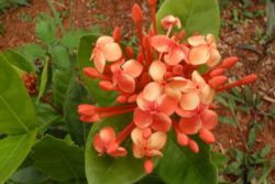
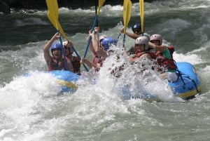
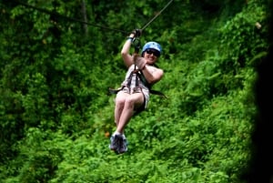
The North Pacific Region of Costa Rica is the most visited area by far of all regional zones. It has several large cities in the Guanacaste and Puntarenas Provinces, numerous coastal towns all along the Pacific shoreline as well as towns, villages and large farms inland. The land mass of this huge region also holds 8 National Parks, more than 10 reserves and refuges, beautiful beaches, primary forest, majestic mountain ranges, amazing gulf's, untouched islands and to top it off, the majority of this area runs along the beautiful blue waters of the Pacific Ocean.

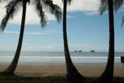
From the Nicaraguan border in the North to the city of Puntarenas in the south. Its eastern region is bordered by the immense Gucanacaste Volcano Mountain Range and the Pacific Ocean to the west. The rolling pastures in between this diverse frame of nature holds some of the largest cattle ranches in the country. As little as 10 years ago many of the small northern coastal towns and the Nicoya Peninsula Region were unexplored as it was difficult to find all the roads leading to its hidden treasures. Once the Tempisque River Bridge was completed it paved the way to access the area easily bringing more families to settle in the areas as well as tourists. With an abundance of land, pristine beaches and amazing wildlife it quickly became the hot spot for real estate, businesses and a major spot for touristism and loads of activities . Other tabs of our web sight will give you the locations and highlights of the North Pacific Beaches, accommodations as well as the abundance of sights and attractions that can be seen in this region.
Guanacaste National Park - The largest tropical dry forest
Santa Rosa National Park - La Consona Santa Rosa Monument
Rincon de la Vieja National Park - Hot springs and mineral baths
Tenorio National Park - Mutiple Volcanoe peaks and craters
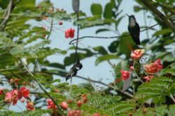
Palo Verde National Park - Birdwatchers paradise
Diria National Park - Wildlife reserve
Bara Honda National Park - Limestone caves to explore
Las Baulas National Park - Leatherback turtle nesting area
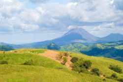
Arenal National Park - Most active volcano in the region
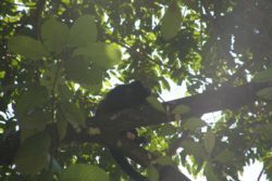
Guanacaste National Park - Spread over 83,000 acres and located in the northern part of Costa Rica you will find Guanacaste National Park. Having primary areas between the wet and dry forest, this park has over 100 species of mammals, 300 species of birds, 10,000 of insects and 100 reptiles and amphibians. Steep terrain surrounding the Cacao Volcano transitions from dry tropical forest in the lowlands to cloud and rain forest in the higher altitudes. This sector protects the headwaters of several important rivers at the continental divide and houses a biological station that conducts research in aquatic biology and insects. There are two other biologivcal stations in the park as well with some facilities and overnight accomodations offered. As you hike through this wonderous area you may come across petroglyphs (rock carvings) that date back to pre-Columbian times as there are hundreds of them scattered about. The slopes of Cacao Volcano, and the majestic conical Orosi Volcano are great attractions with many adventure tours offered and a must see if you are visiting the Guanacaste area.
| Area | 80,300 acres | |
| Max. Elevation | 9,532' above sea level ***** | |
| Temperature | Ranges from 35ºF (in the high altitudes) to 90ºF | |
| Precipitation | 70 to 120 inches annual average | |
| Location | Guanacaste Province, North Pacific Region | |
| Date of Creation | 9 July 1991 |
National Reserves and Refuges around Guanacaste National Park include Bahia Junquillal Refuge.
Santa Rosa National Park - The oldest known developed park in Costa Rica was established to preserve and comemorate the Battle of Santa Rosa which took place on March 20, 1856. This historical battle awarded Costa Ricans the victory over Nicaraguan troops and the country made it a national park in later years. While history books may differ as to the reason the Costa Ricans were willing to bear arms to fight this battle, locals have handed down that William Walker, a wealthy American and slave owner, bent the ear of the Nicaraguan government to seize the land so he could take large portions of it for himself. Few in the neighboring country expected the locals to fight for the land but that proved to be a huge error on their part. Once you visit this beautiful area one can at least understand why William Walker wanted it for himself and why the Costa Ricans were determined to keep it a part of their own country. Santa Rosa National Park has recreational beaches, fields of mangroves, an immense population of wildlife and a lush tropical dry forest with an array of flora. For those adveture seeking surfers, Witches Rock is an experience you should not miss. There are literally activities for all ages and backgrounds to enjoy so you will not want to miss visiting Santa Rosa National Park if your travel adventure takes you to this part of the country. Find accommodations from small hotels to large resorts so you can enjoy this beautiful area.
| Area | 149 square miles | |
| Max. Elevation | n/a | |
| Temperature | 75ºF average | |
| Precipitation | up to 120 inches annually | |
| Location | Guanacaste Province, North Pacific Region | |
| Date of Creation | 1972 |
National Reserves and Refuges around Guanacaste National Park include Bahia Junquillal Refuge and Iguanita Refuge.
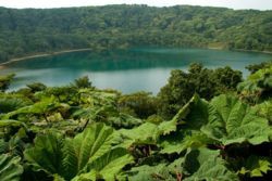
Rincon de la Vieja National Park - Known for its numerous hot springs and mineral baths, Rincon de la Vieja National Park is located in the north-western part of the Province of Guanacaste and includes a highly complex chain of andestic volcanoes. Its name means "The Old Woman's Corner", a reference to a local legend about a young girls whose lover was thrown into the crater by her father. She never left her lovers side and remained on the mountain becoming a recluse until dying of old age. The locals credited her with powers of healing with the mineral baths she had lived beside her entire life. Rincón de la Vieja stands 6,286 ft above sea level and its summit is the highest point in the park with a large number of fumaroles and hot springs covering it's majestic slopes. Taking one of the many trails, which are well marked throughout the park, you will enjoy lush vegitation, many animal species, bubbling springs, freshwater lakes and cascading waterfalls. Experienced hikers may elect to hike to the volcano's summit, a rigorous all-day endeavor, but certainly worth the effort once you clear the summit. There are numerous camping and picnic areas but there are no resources to purchase food so prepare a picnic before you arrive if you plan on spending the day in the park. There is a variety of accomodations offered outside the park in the small village of San Jorge as well as a small airport locally for those that want to fly in for the days adventure. Local adventure tour guides are available to show you the hidden treasures.
| Area | 34,800 acres | |
| Max. Elevation | Rincon de la Vieja 6,286' above sea level | |
| Temperature | Ranges from 40ºF (in the high altitudes) to 90ºF | |
| Precipitation | 100 to 120 inches annual average | |
| Location | Guanacaste Province, North Pacific Region | |
| Date of Creation | 16 November 1973 |
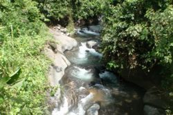
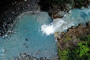
Tenorio National Park - Located 30 miles west of Upala, Tenorio National Park is an array of cloud and rainforest that surrounds multiple volcanoes and craters. The flora and fauna from this mixed environment merge to create a canopy that is easy to spend the day frolicking around in. Hike up to Rio Celeste and experience the aqua blue waters of this pristine river caused by the mineral rich volcanic rock mixing with the annual rainfall. It is the ideal spot to take a refreshing plunge in the waters and enjoy the lush scenery and animals you find along these beautiful flowing waters. Tenorio Volcano, with it's multiple craters, and Montezuma Volcanoe, with her twin craters are considered dormant with no known history of eruption. There are marked trails that take visitors to these wonderful marvels as well as swimming holes and picnic areas along the way. There are no accomodations or resources for food inside the park but the ranger station has an emergency medical kit if needed. Locate accommodations close to this attraction gives you an early start and you can find local tours that offer a variety of activities.
| Area | 31,794 acres | |
| Max. Elevation | 6,286' above sea level at volcano summit | |
| Temperature | Average 75ºF | |
| Precipitation | up to 200 inches annual | |
| Location | Guanacaste Province, North Pacific Region | |
| Date of Creation | 16 March 1976 |
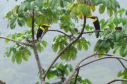
Palo Verde National Park - Located in the heart of the Tempisque basin near the mouth of the Rio Tempisque River you will find the beuatiful Palo Verde National Park. A diverse mixture of habitats, this area is a favorite for the birdwatchers and photographers that visit the country but the regular visitor will not be disappointed either. You are bound to get some great shots of the variety of species natural to the area or the waterfowl that migrate here from North America during the winter. Marshlands, brackish and fresh water rivers and mangrove swamps surround this tropical dry forest that make the perfect ecosystem for the variety of bird and other wildlife species found here. There are trails that will take you along the best viewing areas of the park and overlooks to give visitors the opportunity to get some great photos. The Organization for Tropical Studies operates a Biological Station in Palo Verde and offers lodging, meals and tours. Find accommodations close to this attraction and adventure tours offered for other activities.
| Area | 45,492 acres | |
| Max. Elevation | n/a | |
| Temperature | Ranges from 60ºF to 90ºF | |
| Precipitation | 70 to 120 inches annual average | |
| Location | Guanacaste Province, North Pacific Region | |
| Date of Creation | 30 April 1978 |
National Reserves and Refuges around Palo Verde National Park include Mata Redonda Refuge, Laguna Madrjgal Refuge, Taboga Forest Reserve and Lomas de Barbudal Biological Reserve.
Barra Honda National Park - A tropical dry forest and limestone caves make this park a unique attraction for the visitor. About ten miles past the new Tempisque Bridge you can easily drive to the park entrance of Barra Honda National Park and spend the day hiking in the sun or do some spelunking in the calcareous caves. There are various hiking trails that wind around the park, all of which are well marked for the visitors, giving you loads of opportunity to see some of the wildlife found here. Camp grounds and rustic cabins are also avialble in the event your adventure turns into several days, however, no resource for food is currently offered. For an extended stay your best bet is to stop in Loma Bonita or Tres Esquinas before entering the park. The best time of the year to venture into the limestone caves is during dry season or January through April. Since the caves range from a few feet to over 780 feet deep, the rainy season makes them difficult as well as dangerous to traverse. The ranger station in the park offers equipment and guide services to see these wonderous works of nature up close but reservations should be made in advance. There are camping areas and rustic cabins available in the park and a variety of hotels outside the Park. Local adventure tours are offered to show you additional hidden treasures in and around the park.
| Area | 5,675 acres | |
| Max. Elevation | n/a | |
| Temperature | Ranges from 60ºF to 90ºF | |
| Precipitation | 70 to 120 inches annual average | |
| Location | Guanacaste Province, North Pacific Region | |
| Date of Creation | 3 September 1974 |
National Reserves and Refuges around Barra Honda National Park include Diria National Refuge, Ostional Refuge, Werner Sauter Refuge, Comaronal Refuge, Estica Refuge, La Celba Refuge, Curu Refuge Islas Los Negritos Biological Reserve and Isla Guayabo Biological Reserve.
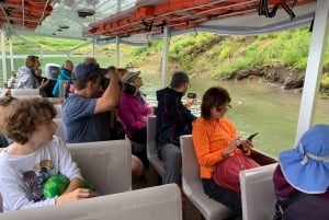
Las Baulas National Park - On the beautiful beach of Playa Grande, near Tamarindo in the North Pacific Region, you will find the entrance to the amazing Las Baulas National Park. It supports the largest nesting grounds of leatherback sea turtles on the Pacific Coast of Costa Rica. These huge sea turtles have their nesting grounds protected by the park staff so only a limited number of visitors are allowd at one time to ensure nothing disrupts these pre-historic marvels. The best time to see the nesting process is November through April but if you miss that opportunity, you can enjoy the endless beaches within the park boundaries or the outlying islands in the Gulf of Santa Elena. There are also several local airports in the area to give additional choices if you want to lengthen your stay and see other activities in the area. Accomodations are not available inside the park but there are many choices in surrounding areas so check the accommodations tab of our web sight.
| Area | 936 terrestrial acres - 54,000 marine acres | |
| Max. Elevation | n/a | |
| Temperature | Ranges from 60ºF to 90ºF | |
| Precipitation | 70 to 120 inches annual average | |
| Location | Guanacaste Province, North Pacific Region | |
| Date of Creation | 9 July 1991 |
National Reserves and Refuges around Las Baulas National Park include Tamarindo Wildlife Refuge, Bahia Junguillal Refuge, Costa Esmeralda Refuge and Iguanita Refuge.
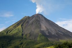
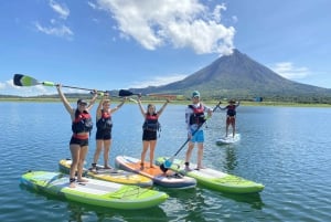
Arenal National Park - Arenal is located 80 miles north of San Jose and is visably the most active volcano in Costa Rica as well as one of the 10 most active in the world today. Arenal displays lava flows and ash clouds most all year round so it is the perfect attraction no matter what time of year you visit this remarkable area. The park is next to the country largest hydroelectric project, the Arenal Lake Dam and is covered with primary cloud and rainforest. As expected in primary forest, it has an abundance of waterfalls, flora, wildlife and thermal hot springs to enjoy along the many trails that are available for visitors. Near the volcano you will find an auditorium and an exhibition hall that holds informative history and details about this beauty of nature and because Arenal attracts so many visitors to its area, there are many choices in accomodations, resturants, tours and transportation. If your view of Arenal is by boat, 4 wheelers or hiking the many trails you will not be disappointed with anything in this park.
| Area | 30,000 acres | |
| Max. Elevation | 5,436 feet Volcano Summit | |
| Temperature | Ranges from 75ºF (in the high altitudes) to 90ºF | |
| Precipitation | up to 200 inches annual average | |
| Location | Guanacaste Province, North Pacific Region | |
| Date of Creation | 6 November 1991 |
National Reserves and Refuges around Arenal National Park include Curi Cancha Refuge, Alberto Manuel Brenes Biological Reserve, and Penas Blancas Refuge.
There are 17 amazing National Parks to see in the beautiful country of Costa Rica and they are scattered from one end to the other, so no matter what direction your travel plans take you in - there are wonderous sights and adventures for you to experience. Once you locate which one of these marvels you want to enjoy, check the tabs on our web sight for further details, accomodations and other attractions that you can combine for your memorable trip.